Three Men in a Boat
It is difficult to say where this story begins. In one sense it began when I first went sailing, whilst on holiday in France at the age of 11. Or perhaps it began with my first introduction to the Norfolk Broads, the following year. Rediscovering the Broads in recent years on a family holiday also played its part.
At any rate, a few years ago the idea was conceived that my dad, David, would like to join his two elder sons, Jon and myself for a sailing trip on the Broads.
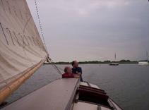
What follows is an account of that trip, which finally took place in June 2005, but first a bit of background. It’s time to meet the place, the boat, the crew and the idea. Then we can move on to the diary of the trip.
- Log in to post comments
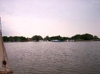
The Norfolk Broads
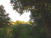
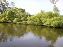
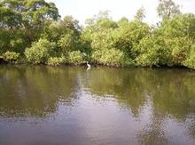
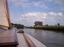
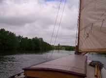
Situated in eastern Norfolk and, to a lesser extent Suffolk, the Broads consist of about 120 miles of navigable rivers, all to a greater or lesser extent tidal. The Broads themselves are shallow lakes, originally mediaeval peat workings. Some are landlocked, whilst others are connected to the rivers. Of these, a significant proportion are open to the public, and navigable. Details of this fascinating environment, can be found on the Broads Society and Broads Authority websites. For our purposes it is sufficient to know that the rivers vary in width from very wide to narrower than the 27 foot yacht we are sailing; that the tides vary from very fast to negligible; that further upstream the rivers are often tree-lined, which is picturesque, but blocks the wind; that there are a lot more motor cruisers than yachts; that the wind always seems to blow from ahead; and that there are pubs at frequent intervals along the river banks. There are also frequent road and rail bridges crossing the river. This means that we have to lower the mast (which is hinged and counterbalanced), and use the quant pole to make progress. The Broads area is also a unique and beautiful environment, rich in wildlife and history. See the Broads Society for lots more fascinating detail.
- Log in to post comments
The Boat
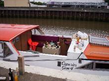
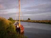
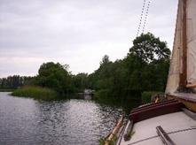
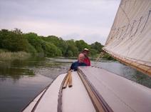
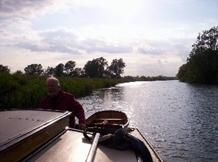
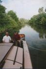
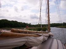
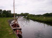
Over the years I have sailed boat from several Broads yards. Many of these have now withdrawn from the sailing market and only offer motor boats. In recent years however, I have discovered the delights of Hunter’s Yard. The yard, tucked away at the end of its own little dyke off Womack Water is almost like a time warp. There are no motor boats and all the yachts are traditional wooden vessels in varnished mahogany. As an avowed traditionalist I find the Hunter’s boats, which were built in the 1930’s and 40’s offer the kind of experience I seek. Gaff rigged, un-modernised, and without the dubious benefit of an auxiliary engine, progress is entirely dependent on the wind and the crew’s muscle. There is no electricity aboard. Lighting is by oil lamps and cooking is a gas stove outside in the well. Headroom in the cabin is sitting only, although a lifting central roof section allows an improvement when moored up. A clockwork radio will serve for weather forecasts, and mobile phone batteries will have to be carefully conserved.
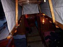
Our particular boat on this trip is Lullaby, a four berth craft built in 1932. She is therefore of similar age to our oldest crew member. The fourth berth allows the luxury of a bit more space. We will also take with us a small pram dinghy, equipped with oars and a tiny lug sail. This will be towed behind.
I have sailed Lullaby before, and am looking forward to the re-acquaintance.
- Log in to post comments
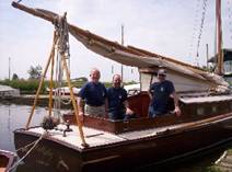
The Crew
|
David |
Jon |
Robin |
|
|
|
|
|
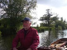
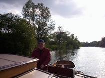
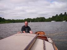
In his seventy fifth year, David proves that you don’t have to start young to be a Broads sailor. His sailing experience is limited, but includes several forays into the Solent as crew on various yachts, as well as some dinghy sailing with Robin and Jon many years ago. He is looking forward to the trip with much enthusiasm. |
Jon started sailing at school, where it was available as a sporting option. He and Robin also raced a 505 dinghy in their teen years. Since then his forays afloat have been intermittent, but have included dinghy sailing and coastal excursions with friends. He has also made two previous Broads trips with Robin. |
Robin has sailed since age 11 and first sailed on the Broads in 1968. School and the 505 were replaced at university by team racing in Lark dinghies, and then in 1976 a summer season as a sailing instructor on the south coast. Over the past few years he has returned to the Broads several times with Jon, with his family and also single-handed in Hunter’s day boats. |


- Log in to post comments
The Idea
The first bit of the concept was simply that the three of us should have a sailing trip together. We settled on June as the ideal time for the long days and generally good weather. Around 17 hours of daylight allows for a lot of options. We are aiming to get as much sailing in as possible. However, as the holiday gets nearer, Jon raises an interesting question. Shortly afterwards he is to visit Uganda to work with the Romans One Eleven Trust. He is interested in the idea of being sponsored to raise money to support the work of the trust. The question is, how would such sponsorship work?
Being sponsored by the mile seems a bit tame and ordinary but after a couple of telephone conversations during which ideas get kicked around we settle on what we believe is the most interesting way of approaching this. We will endeavour to reach the limit of navigation on every branch of every river.
One problem with navigation limits is defining them. The main ones are obvious, but if you decide to count the head of every publicly accessible dyke, then the whole exercise becomes ridiculous. It is also compounded by the fact that there are places that the yacht cannot reach, but which may be accessible by dinghy. The North Walsham and Dilham canal certainly used to be navigable as far as Honing Lock, but is rumoured to be too overgrown. At the upper end of the Bure, Coltishall lock is no longer operational, but the river above is navigable for a further 12 miles to Aylesham in a small craft which can be carried round the lock. The Waveney has canoeing above the navigation limit at Geldeston Lock, but we have no more details about what is possible.
Eventually we settle on the following, arranged by river:
 River Bure
Coltishall
Aylesham (by dinghy)
River Ant
Dilham
Honing Lock (by dinghy)
River Thurne
The Pleasure Boat, Hickling
Bridge Farm, Waxham New Cut
Horsey Mill
West Somerton
River Yare
Norwich
River Chet
Loddon
River Waveney
Geldeston Lock
Lowestoft (Mutford Lock on Oulton Broad)
Another suggestion comes from David. He is keen to support an organisation which he is involved in, the Guillain-Barré Syndrome Support Group. He is himself recovering from Guillain-Barré Syndrome and has been acting as a research “guinea pig” Therefore he suggests that we each try to raise money for an organisation we wish to support. On this basis I decide to seek sponsorship for The Association of Young People with ME (AYME). Both of my children have ME (Myalgic Encephalomyelitis), and AYME has been a great support to the whole family. Jon will, of course, stick with the Romans One Eleven Trust.
So that is settled. A sponsor form is prepared, listing the ten navigation limits and the two extra “dinghy only” ones. Along with all the other preparations, we now have the job of recruiting sponsors.
- Log in to post comments
The Trip
As the 9th June approaches, preparations are completed. Along with the usual requirements of clothing for all weathers, sun cream, waterproofs etc. a few special things need to be arranged and packed. Jon is planning all the food, and will bring as much as possible to avoid the need for shopping. Much of it is frozen and stored in cool-boxes, where it will defrost slowly. Even so, with no fridge we will have to start shopping for fresh stuff sooner or later. Robin is bringing a cask of home made beer, which has been maturing for the last three weeks, and each of us will bring three bottles of wine, making one bottle available for each night of the trip.
There are also the background information and navigation documents and tools. The boats are well equipped with a comprehensive information pack, but I still like to add my Hamilton's Navigations for its detailed descriptions of every stretch of the river, and its inclusion of much fascinating background and historical detail, It also has excellent pub recommendations, which favour real ale, good food and quiet atmosphere. Along with this I have the 1:25000 Ordnance Survey map of the Broads (waterproof version) and a GPS receiver. The 1:50,000 Landranger map is provided in the boat's information pack. I also have printouts of some of the excellent information sheets from norfolkbroads.com
- Log in to post comments
Day One, Thursday 9th June
Great Yarmouth 9/6
7am: 11c WD 210deg WS 0kt VIS 24km RAIN 0%
1pm: 12c WD 180deg WS 5kt VIS 21km RAIN 0%
From the early planning stages, we have intended making as early a start as possible. I have left home in Yorkshire the night before and headed to London, where I am joined by David, who has travelled up from Winchester. We are staying overnight in London and travelling together the next morning. Jon will travel in the morning from his home in Nantwich. David and I enjoy an excellent dinner at the Acropolis restaurant in Acton, before retiring for an early night.
We arise early the next morning and are on the road by five o’clock. Before leaving I send off the text to subscribe to Marinecall. This will deliver a simple Great Yarmouth weather forecast every morning at around 08:00 (see above). We enjoy a trouble free journey which includes a stop for a substantial breakfast. Shortly after nine we are at the yard. Unfortunately, despite a similar early start, Jon is not so fortunate with the traffic, so David and I are able to have a trip into Ludham village for a cup of tea, and still have the boat prepared for departure by the time Jon arrives.
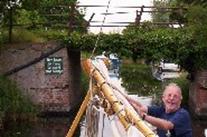
After several phone calls with progress updates. Jon finally makes it for 11:45. We are ready with a trolley for the luggage. Everything is rapidly stowed and we are under way by 12:15. The light SW wind gives us an easy reach down Womack Water, and we turn up river towards Potter Heigham. It does not take us long to reach the outskirts of Potter Heigham and for once he journey past the riverside bungalows is relatively straightforward. It is still close season for fishing and so the banks are not lined with rods, and the wind direction is such that we are not heavily blanketed by the bungalows. So we are able to moor up ready to drop the mast for our first bridge by 13:10.
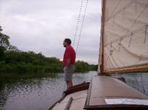
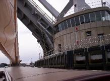
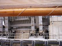
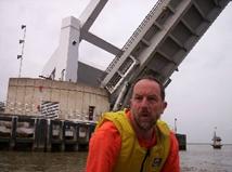
Potter Heigham is blessed with two bridges. The original bridge is a mediaeval stone arch and is the smallest on the Broads. Many cruisers are unable to pass through, and I can recall on a trip some years ago when one of the yachts in the fleet had a higher cabin roof than most. The mast was dropped onto the roof itself, and even then it took two people hanging on to the end of it to bend it enough to fit through. Anyway, we have no such problems. David has his first experience of “masting” without any problems, and by 13:45 we have passed under both this and the newer bypass bridge, we have hoisted sail and are under way again. Our intention is to make as much progress as possible towards the four navigation limits up the river Thurne.
The first choice comes within half an hour, as, having passed Martham boatyard, we reach the entrance to Candle Dyke. The wind has now moved to the south, as forecast, but it is still possible to get back down the dyke on a fine reach with relatively few tacks. This is just as well, as this far up the Thurne, the river is narrow enough to make tacking difficult. We opt to head up the dyke towards Hickling Broad. This will also give us a large expanse of water for David to develop his familiarity with the boat. We pass the eel sett and continue into the wider expanse of Heigham Sound. Much of the sound is to shallow to navigate and the way through is marked by posts. It is as well to stay within the posts. As Jon and I discovered on an earlier trip, the mud is particularly glutinous, and we were only able to get free by jumping into the water and pushing. We pass the yellow top marker post indicating the junction with Meadow Dyke. We’ll be going that way later. Through White Slea, and we come out into the vastness of Hickling Broad. Parts of the broad are shallow, and the safe areas are marked with posts, but there’s plenty of room for a practice sail, and what is more, at 15:20 we reach our first objective, The Pleasure Boat Inn, at the top of the broad. Navigation limit number one has been reached.
With many miles to cover, we forgo a pint at the Pleasure Boat, and simply turn around, capturing a picture of the moored boats as we go. Not only do we want to make progress, but also two of Jon’s friends, Ron and Jean, are on holiday in the area. We are meeting them later for a meal.
So it’s back to Heigham Sound and the left turn for Meadow Dyke and Horsey Mere. The plan is to go up Waxham New Cut to Bridge Farm and then return to Horsey Staithe to meet Ron and Jean. The journey back down is easier than expected as the wind veers to the north west, so it’s a run down and then a reach up Meadow Dyke. By the time we get on to the Mere the wind is almost due north. This means that to go up Waxham New Cut will be straight in to it. I have been up to Bridge Farm once before, and know that it is far too narrow to tack. In fact, in many places it is too narrow to turn round. It’s like being on the canals; you have to carry on until there’s a turning space (a winding hole to canal lovers). However, if we are to make progress, then up the Cut is where we are going, so in the entrance to the cut (found by aligning two triangular leading marks), we drop the sails and resort to quanting.
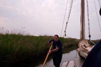
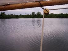
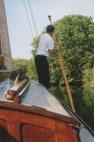
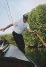
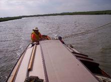
For the uninitiated, a quant is a long wooden pole (about 16 feet) with a fork on one end and a button on the other. The technique for making progress is to stand on the side deck by the shrouds, raise the quant vertically in the air (forked end down) and then drive it down in to the water. It is then possible to propel the boat forward by heaving on the quant until it is angled sufficiently to lean against the button. With a shoulder pressed to the button, walking to the back of the boat provides even better forward propulsion. The most critical bit comes on reaching the stern. The quant must be freed from the mud with a sharp twist and jerk, without either letting go, or even worse, falling in. The whole process is then repeated. In this manner we arrive at Bridge Farm at 18:30. We have already reached two of our limits.
The normal procedure at Bridge Farm is to drop the mast and go through the bridge to turn round in the small basin beyond. However there are no boats on the private mooring just below, so we conclude that there is just room to turn below the bridge. This saves us the delays associated with masting. Time saved is a good thing, as we are keen not to keep Ron and Jean waiting. We would like to set off sailing back down as quickly as possible. With the wind behind us, and no room to turn, going down under full sail would not be a good idea. There is nowhere to go if anyone comes the other way. However I intend to run down under jib alone. Unfortunately this is not to be as the north wind has died completely. We therefore resort to the quant again. Once clear of the moorings we adopt another Broads technique and opt for a tow. This is not some cheat involving a motor boat, but relies on muscle power. One end of a long rope is tied to the base of the mast. It is then passed round the shrouds and the other end given to a crew member ashore. The boat can then be manually pulled from the bank. Jon and I both take our turn at towing, and collect the usual assortment of nettle stings, bramble scratches and wet, muddy feet. Occasionally we have to resort to the quant to get past an obstruction.
Even out on the Mere there is not breath of wind, and so we quant as quickly as possible across to Horsey Staithe. Three limits now attained! At the head of the Staithe stands Horsey Mill. This fully restored old drainage mill is now owned by the National Trust and is open to the public. We will not visit, as it has long since closed for the day and we will leave before opening time in the morning. It is still fascinating to stand on the little bridge by the mill and see clearly how the fields lie several feet below river level.
Horsey stands out for only being just over a mile from the sea, despite being some 21 miles upstream from Great Yarmouth. Ron and Jean are waiting on the bank as we arrive. We moor up at about 19:40 and they whisk us away in their motor caravan to the Nelson Head for real ale and an excellent meal. Replete, we return aboard and settle down for the night. We have reached three of the navigation limits on day one, but we know that the others are much further apart and we will not repeat this feat.
|
Yacht Mileage |
14 |
|
Navigation Limits |
3 |
- Log in to post comments
Day Two, Friday 10th June
Great Yarmouth 10/6
7am: 12c WD 339deg WS 4kt VIS 7km RAIN 0%
1pm: 12c WD 18deg WS 9kt VIS 10km RAIN 0%
At 06:30, as we get up, the four knots of wind forecast seems optimistic, there is hardly a breath. We therefore have a cup of tea before setting off. By 07:10 we are refreshed and the awning is stowed ready to depart. There is now a hint of the forecast north westerly breeze, so we quant out onto the Mere, where, clear of the trees, there is enough wind to sail. We moor to a mud weight, hoist sail and are off. Today’s plan is to visit the next limit of navigation, West Somerton, and then sail down to Yarmouth Yacht Station, ready to make the passage through Yarmouth the next morning. Yarmouth is notorious for its strong tides, and a passage through can only be undertaken at slack water, about an hour and a half after low water. Slack water today is too late to reach a safe mooring beyond Breydon Water by sunset, so we will moor at the Yacht Station and go through on the morning tide. One result of this is that we have time to spare. There is no advantage to being at Yarmouth before slack water, and there is no time, if we are to go through Yarmouth in the morning, too reach any further navigation limit in the northern rivers. So before we set off down Meadow Dyke, there is time for David to hone his helmsman’s skills in the expanse of the Mere. With the wind in the north, the trip down Meadow Dyke, Heigham Sound and Candle Dyke is straightforward and David sails the boat downwind through the Sound.


We turn up river at the entrance to Candle Dyke, and almost immediately pass through the very primitive hand operated swing bridge at Martham Ferry. This bridge is normally open, but the uninitiated need to be aware of a sizeable concrete slab on the left bank. At certain states of tide this can be underwater and invisible. We pass this hazard without incident and carry on across Martham Broad. Martham Broad is reed covered such that the river feels no wider than on the approach, but one the way across there are occasional glimpses of open water beyond the reeds. These areas, inaccessible to boats, are a haven for birds.
The approach to West Somerton is due east. This means that with the north wind, it will be a reach both ways. However, the river is narrow and there is no room to turn except right at the end. We intend to turn and head straight back. I have stopped here on a previous occasion and there is a pleasant pub a short walk away, but we haven’t yet had breakfast.


We turn at the end of the river at 09:40, thereby achieving navigation limit number four, and head off back across Martham Broad. Just below the broad we find a pleasant bit of bank and moor up for breakfast. Jon has planned the catering well, and we enjoy the first of many traditional breakfasts of bacon, egg and sausage, washed down with copious draughts of tea.
Again we pass Martham Ferry and with the wind behind us, we make rapid progress to Potter Heigham, where once again we must pass under the bridges. There is plenty of mooring for masting and we pass through the first, modern bridge then quant on down to the mediaeval arch.

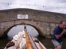
The approach to the old bridge is always difficult. The flow is constrained to the small arches and there are unpredictable eddies. Also motor cruisers and day boats often have no idea of giving way to an un-powered craft.
Anyway, we fit neatly through the centre of the arch and carry on down to moor just below Herbert Woods basin to raise the mast.


With no pressure on time we decide to moor up for lunch. Our chosen spot is at the entrance to Womack Water, where a leisurely break is accompanied by a stroll up to the yard to pick up a buoyancy aid for Jon. In the hurry to get away we had forgotten to collect one before departure.
Continuing down river we pass Thurne Dyke with its white painted windmill, a landmark from many miles away. Moored at the dyke entrance is one of the many yachts named Teasel, after the boat featured in Arthur Ransome's "Coot Club". We feel slightly superior as Lullaby actually played the part of Teasel in a BBC film some years ago.
Just below the dyke we join the river Bure at Thurne Mouth. From here the river downstream is much wider, but he tide is now stronger and will increase yet more as we draw near to Yarmouth.
Less than three miles below Thurne Mouth is the road bridge at Acle. This is a big, wide bridge and there are no worries about fitting through. The problems here can occur because parts of the river are too deep to quant. I have also had a situation here when it has been impossible to quant against the wind, and we have had to tow through, wading on the shallow foundation of the bridge abutment to pull the boat along. Today we have no such worries, with the tide and a moderate breeze behind us. Our only concern is arriving at Yarmouth too early. If the tide is still strong it will be impossible to get ashore with a mooring rope.
Whilst we are moored up for the bridge I make a call to the Yacht Station. I explain my concern and they confirm that they can be available to take a line and it will be OK to arrive early. It is as well to check; normally the Yacht Station staff seem to assume that the crew of Hunter’s boats are unlikely to need assistance and will leap to the aid of a motor cruiser instead. This is probably a valid approach as we do tend to be aware of the potential problems. I would certainly not be there until slack water without the assurance of confirming that they would be to hand.
So with no reason to delay, we are on our way shortly after 18:00 and we are soon past Stokesby with its wonderful pub, The Ferry Inn. (The ferry itself ceased many years ago). Below Stokesby are some of the most desolate reaches of all the rivers. This feeling is heightened because one is always there as the tide is low and the horizon is limited by reeds and mudbanks. Go aground here and you have only moments to get off if you’re not going to be stuck until the tide rises.
We carry on through the reeds and marshes with the only landmarks being the Stracey Arms (It will always be known as the Stracey Arms, even though it has been renamed, after all it’s on the Hamilton’s chart). It must say something that I can’t even recall what it’s now called. Below here the only landmarks are the isolated buildings of Six Mile House, Mautby Marsh Farm and Three Mile House. At Marina Keys I ring the Yacht Station to warn them that we are approaching. 19:30 sees us coming alongside at the Yacht Station. The tide is still very strong, but with both wind and tide behind us, we are able to turn up into them both as we come alongside and throw our lines to the Yacht Station staff who are waiting for us ashore.
We are swiftly made fast, and I sort out extra ropes to use as springs. This arrangement allows the boat to lie comfortably alongside whichever way the tide is flowing and with enough slack for the tidal rise and fall (several feet).
Once everything is stowed, we walk down to the White Swan Inn. The riverside parking is a mass of gleaming chrome as a huge party of bikers have descended on the pub. Much as we enjoy the company of bikers, the queues at the bar are massive, so Jon returns to the boat to cook whilst David and I take a walk down as far as the railway station, where we can look out over Breydon Water and I can explain how we will make our trip through in the morning.
We return to the boat where an excellent meal is awaiting. This is washed down with a bottle of wine and we turn in for sleep. The only thing we miss is a shower; the yacht station showers are closed as there is new laid wet concrete on the step in front of them.
|
Yacht Mileage |
25½ |
|
Navigation Limits |
1 |
- Log in to post comments
Day Three, Saturday 11th June
Great Yarmouth 11/6
7am: 10c WD 311deg WS 4kt VIS 18km RAIN 0%
1pm: 11c WD 346deg WS 9kt VIS 22km RAIN 35%
Our night’s sleep has been much disturbed by a group of young people on two nearby motor cruisers, who have been drinking and making noise until well into the early hours. We, together with the yacht station staff, gain some small sense of satisfaction as we converse loudly whilst picking our way through the abandoned beer cans and other debris that litter the bank.
Rather than hoisting sail, preparation consists of lowering the mast ready to pass under the two low bridges. In an un-powered yacht, this can only be done at slack water, when there is virtually no tide. We cast off at 08:30 and quant down under the bridges. I have already telephoned the Breydon Water lifting bridge to ask for a lift. They will be looking out for us. Quanting down this bit of the Bure is easier than it used to be. Silt deposits mean that the quant will actually reach the bottom and there is no need to rely on paddling with mops, frying pans and the dinghy oars. The oars are however, aboard the boat in case of need.
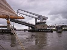
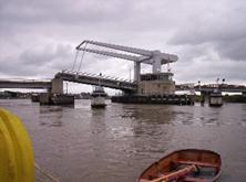
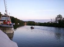
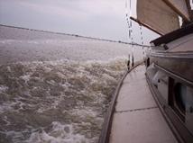
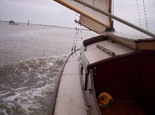
Immediately below the second bridge are three steel and wooden “dolphins.” These provide a mooring from which to raise the mast and hoist sail. We moor up to the second, being very careful to position the fenders to protect the boat from the barnacle encrusted rusty metal. Mast and sail go up and we cast off for the few hundred yards to the lifting bridge. True to their word, the bridge crew are ready. We see the traffic stop, the siren is sounding and as we round the marker post on to Breydon Water, the span begins to rise. It’s a great feeling to be holding up the bypass. With the brisk north-west wind we are approaching the bridge too fast so we have to take a turn back whilst it finishes opening, but soon we are through and on our way across Breydon Water. Crossing Breydon is a unique experience in Broads sailing. The channel, marked by posts, is wide enough for good long tacks, although today we can cross on a fine reach and the water spilling over the mud flats as the tide rises leads to a feeling of being out on open water. The banks are a long way away.
The 4½ miles pass quickly and it is decision time. The Yare or the Waveney? With the north west wind persisting we will have an easier trip up the Waveney, and if the wind goes south, as is likely over the next day or two the trip back will be easy as well. So we turn left and pass Burgh Castle roman fort and the marina. We continue up the reed lined river to the first real civilisation at St Olaves. Here a low bridge crosses the river. The tide is even stronger here than at Acle, and again there is no certainty of touching bottom with the quant. We moor up just below the bridge and after dropping the mast we take a short trip ashore to visit the quaint, antiquated village shop. We are out of luck today as the shop is closed so we return to the boat and make our way through the bridge. The moorings upstream belong to the village pub, The Bell Inn. I know from previous experience that the food and beer are both excellent, but today we are going straight on. A sign requests that boats moor stern on to save space, but that is not an option for us, and besides, the moorings are not busy. We moor facing downstream so that we are head to wind and tide, raise the mast, make sail and we are away. Just outside St Olaves is the entrance to New Cut, an artificial channel linking to the river Yare at Reedham. It is just past the entrance to the Cut that disaster strikes. Jon, at the helm, is heading up what should be a wide and open river when there’s a loud crash and shake and we come to a halt. We have hit a dredging platform moored such that it sticks out into the river.
We push ourselves free and I make a quick damage assessment. The rubbing strake has been torn and the chain plate for the forward shroud has been ripped from the hull. The jib boom is also split. It is clear that we will need to call the boatyard to arrange a repair. The problem is where to moor up? St Olaves is the nearest place, but we would need to go back against the wind and tide. With the broken shroud we dare not sail to windward on the port tack. A look at the map shows public moorings just below the railway swing bridge at Somerleyton. It is all downwind and we will be able to turn up into wind to moor. There is also vehicle access for the yard’s van. With this plan in mind I make the difficult call to the yard. Graham agrees that it is the best option and says that they will be with us as soon as possible, but that there are some jobs to finish in the yard before they leave.
We make Somerleyton without further incident, moor up and have lunch. With a substantial wait for the repair, David and I decide to venture up to the Dukes Head for a couple of excellent pints. Jon elects to remain on board. Refreshed, David and I return to the boat. The gas is lit under the kettle and it is nicely boiling when Graham and his colleague from the yard arrive. They waste no time in setting to work. The holes are filled with resin. The chain plate is re-fixed and a new section of rubbing strake is fashioned out of a piece of mahogany. The jib is attached to a new boom. It is fascinating to watch true craftsmen at work. By 16:30 all is done and there is no sign of the damage other than some sticky tape over the resin to keep it dry until it sets.
We set off again and the swing bridge duly opens to let us through. We would like to make Beccles tonight, but with the tide now against us we make slow progress to the mouth of Oulton Dyke. Beyond the Dyke progress slows even more as the wind dies and in less than three miles we are forced to give up. We find a pleasant mooring on the north bank just below Castle Mill and away from all civilisation, with just a rural footpath along the bank.
A probe with the quant shows that the water on this bank is fairly shallow. We should be OK, but I resolve to check as we approach low water at 23:00. It turns out that such caution is unnecessary and there is plenty of depth.
|
Yacht Mileage |
17 |
|
Navigation Limits |
0 |
- Log in to post comments
Day Four, Sunday 12th June
Great Yarmouth 12/6
7am: 11c WD 221deg WS 4kt VIS 24km RAIN 0%
1pm: 14c WD 254deg WS 7kt VIS 5km RAIN 70%
At 04:30 I am up and having a look outside. If conditions are suitable we will get under way and make up for lost time. There’s no wind and a low mist over the river so we will be unable to make progress against the tide. I go back to bed having resolved to be under way by 10:00, when the tide will be about to turn.
The later start gives us time for a leisurely breakfast followed, as it is Sunday, by celebrating an informal Holy Communion led by our resident Minister in Training, Jon. We finish both as the wind picks up and so just after 09:00 we get away and make progress against the last of the falling tide. The plan for the day is to carry on up the Waveney, through Beccles and to Geldeston Lock. This will achieve the first limit of navigation on the southern rivers. With more west in the wind we have to tack up some stretches, but by lunch time we are approaching Beccles.
Beccles is a lovely town. The town centre is full of wonderful old buildings and a quaint narrow road leads down to the water. Today however, we are not going to explore the town. We moor at the yacht station just for long enough to lower the mast.
Beccles bridge is low, with only just over six feet of clearance at high water, but it is not arched so the passage through is fairly straightforward. Once through we look for a mooring but unable to find anywhere, we drop the mudweight whilst we raise the mast. Lunch is taken under way and we carry on up the river. The banks are now much more tree lined and occasionally blanket the wind enough to have to assist progress with the quant. Shortly before the junction where the Geldeston and Geldeston Lock routes diverge, we spend some time in the company of a River Cruiser class yacht. With their large sail area they eventually leave us behind and we continue alone.
Shortly afterwards we have a close encounter with an overhead hazard, although well away from the bank we catch the rigging in an overhanging tree. Of course it is at that moment that Chris, the Hunter’s Yard administrator, passes by in her motor boat. How embarrassing! The debris is still on the cabin roof as, at 15:50, we arrive at Geldeston Lock, our fifth navigation limit. We don’t waste time celebrating, but turn straight round for the journey back.
Once again, progress is gentle through the tree s as we head back down towards Beccles in the gentle breeze, which now comes from the south west.
Approaching Beccles, and remembering the lack of mooring on the way up, we elect to lower the mast whilst under way. This technique only works in a very light wind and is hard work with a crew of only three: one to lower the mast, one to quant and grab the mast as it is nearly down and one to steer.
Below Beccles there is a bit more wind as we clear the trees, and we make our steady way down the river. This part of the Waveney is a lovely river. There are enough trees to break the monotony, but not enough to blanket the wind. We make gentle but steady progress back downstream, helped by the wind, which is now almost due west.
In this relaxed fashion we eventually reach the entrance to Oulton Dyke, our route to Lowestoft. A steady reach down the dyke a run across the broad and in to moor at the Yacht Station at 19:30. We have arrived in Lowestoft. Limit number six.
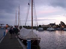
Oulton Broad is one of my least favourite parts of the Broads. It is highly commercialised and home to powerboat racing. This is not a concern right now, at this time of day all is quiet and the Yacht Station is not crowded. Our nearest guests are two sailing yachts from Southgates Yard, whose crews express admiration that we have come so far without an engine. Things improve even further as I go to pay our mooring fees. The harbourmaster is an enthusiast for traditional yachts and we spend a happy quarter hour reminiscing about the sailing yachts we have known over the years.
Back to the boat and another superb meal courtesy of Jon then we go ashore for a beer. We try the nearest pub, which is not inspiring so we take a walk to look at Mutford Lock. The lock separates Oulton Broad from Lake Lothing, a part of Lowestoft harbour and was built to allow trade via Lowestoft to reach the Broads. It is unusual in having two sets of gates at each end. Depending on the tide, Lake Lothing may be higher or lower than the broad, so the lock must work both ways round. By the end of our stroll it is fully dark, and we retire below.
|
Yacht Mileage |
23½ |
|
Navigation Limits |
2 |
- Log in to post comments
Day Five, Monday 13th June
Great Yarmouth 13/6
7am: 8c WD 274deg WS 9kt VIS 14km RAIN 0%
1pm: 13c WD 243deg WS 12kt VIS 15km RAIN 48%
Today’s plan is to work our way back down the Waveney to New Cut and up New Cut to the river Yare. We can then make our way towards either Norwich or Loddon as appropriate. An early trip ashore to the little general store by the Yacht Station is thwarted as the bread delivery has not yet arrived, so we have breakfast and make a further trip ashore for bread. The up side of this is that the butcher is also open and we are able to buy some excellent chops and some bacon.
When we do depart, with the wind now in the west, we will be unable to sail off the pontoon safely. A conversation with our neighbours in the Southgates yachts and we agree that we will manhandle our boat around theirs and on to the other side of the pontoon. This accomplished we are under way by 09:30 in an excellent force three breeze. Up the dyke and on to the Waveney again, we head downstream. Initially we make good progress, and pass through Somerleyton swing bridge with no difficulty, but further downstream the wind is dropping and the tide is turning against us.. Getting through the pillars that remain from the old St Olaves swing bridge proves tricky, and below there, as we approach St Olaves, the wind is distorted by the trees and we have to make a few tricky tacks to get into New Cut across the flood tide. Once in the cut and clear of the trees it is clear that the wind is still south of west and we will not have to tack up the cut. This is just as well as major dredging and bank rebuilding works are under way. It would be difficult to tack past them.
A short way up the New Cut the main road from Great Yarmouth to Beccles and Bungay crosses. Haddiscoe bridge, with 24 feet of clearance, was built to allow larger trading vessels to get from Lowestoft up the river Yare to Norwich. Unfortunately 24 feet is not quite enough for us, and the mast must come down. The previous year I had experienced difficulty with getting through because of dredging platforms close to the bridge and very shallow water on the north east bank. Today, with the wind in the south west we can manoeuvre on the other side. There is plenty of depth and good piling, but the bank is overgrown. Bramble scratches and nettle stings are the inevitable result. Once through the bridge the only problem is that we must let the stern out into the cut so that we lie head to wind to hoist sail. With the dredging works this will effectively block the channel, so we have to wait for a suitable gap in the traffic.
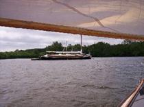
The gap appears, the sails are hoisted and we are away. Clear of the bridge, the wind picks up again and we make steady progress on a beam reach. New cit is a straight line for its entire, nearly three mile, length. With the good breeze we keep pace most of the way with a little motor day boat and periodically we are overtaken by a train on the track that runs parallel for most of the distance.
At the north end of the cut we pass the Motor Torpedo Boat that has been moored there for many years. Immediately in front of us now is Reedham Swing Bridge. The tide is strong at Reedham and care must be taken. It would be easy to be carried down by the tide, and the bridge is closed. Today though, we have a good enough wind to make our way back and forth until the train passes and the bridge opens. Unfortunately the railway swing bridges are not on the telephone, so ringing up for an opening time is not an option. We sail back and forth for around quarter of an hour, two trains pass and then the bridge opens. We can carry on.
Above the bridge in Reedham, are the very busy town centre moorings, and under sail, stopping can be difficult if the wind and tide are n opposite directions or the town shore is the lee. Today however, it is fine. We come alongside head to wind and tide. We replenish our water carriers and adjoin to the Nelson for refreshment. Suitably replete we are under way again and continue past the boatyards where we see the beautiful and fast modern River Cruiser class yacht “Farthing” moored up. Another couple of bends, with some tacking where the bends take us in a more southerly direction and we are at Reedham Ferry. A chain ferry provides a crossing for cars. It plies to and fro with scant regard for other boats. The technique is to pass behind it. In front the chains are under stress and may be only just below the surface.
Just past the ferry is the mouth of the river Chet, with its stone signpost, but we decide to continue toward Norwich and save the Chet for our return. We have no trouble passing the sugar refinery at Cantley, where often the wind is blanketed. Just above is the Red House, which has been refurbished and reopened. On a previous family trip, this was the scene of a great disappointment. We had come through Yarmouth and up the Yare. We stopped at the Berney Arms at lunch time, only to find (this was late September) that they were now on winter hours and didn’t open at lunch times. No matter, we were planning a bar meal that evening and would stop at the Red House. When we moored up I took a walk over to the pub only to find that it had closed down. There was even a poster for the last night party some three weeks earlier. With little food on board and a serious thirst, we had quanted the mile further up river to Langley Dyke, and had moored at the Staithe. Just about to head off to the pub, The Wherry, we entered into conversation with a couple moored next to us. Imagine our horror on learning that The Wherry, too, had closed down. We dined frugally and drank just tea that night. Things were no better the following night. I knew that the Woods End was a busy, thriving pub; I’d been there a couple of weeks earlier. Unbelievably, when we arrived we found it closed for a private party.
Anyway today we intend to keep going as far as possible. We pass not only the Red House and the Wherry, but also the Beauchamp Arms, with its adjoining sailing club. On past Short Dike and The Fleet, the two entrances to Rockland Broad and we are nearing Brundall.
Brundall is not a pretty place. Boatyards and bungalows line the river and access to the village centre is across the railway line. Fortunately there is an alternative. A cut through Surlingham Broad is tranquil, picturesque and shorter. So that’s the way we go.
Sheltered by the trees, we need to use the quant to help us along the dykes but soon we are back in the river and passing Brundall Gardens. By now the wind is dying away and the tide has turned. Progress is laborious and we frequently need the assistance of the quant. We therefore make the sensible decision to call it a day at Bramerton Woods End.
This time the Woods End Tavern is open and we enjoy a couple of well earned pints. Norwich is still however, a long way off and a plan is required. Our trip back through Yarmouth has to be matched exactly with the tide and that tide is early in the morning. It is now Monday and we are due back on Friday. If we are to explore the rivers Bure and Ant, we must go through Yarmouth no later than Wednesday morning. We reluctantly conclude that we cannot get all the way up to Norwich Yacht station, but then we hit on an idea. We may not get right to the limit, but we can make a token visit to Norwich. Jon will take the dinghy at first light and row up to Postwick Bridge on the Norwich bypass. With this plan agreed it’s time for bed.
|
Yacht Mileage |
23 |
|
Navigation Limits |
0 |
- Log in to post comments
Day Six, Tuesday 14th June
Great Yarmouth 14/6
7am: 12c WD 245deg WS 9kt VIS 19km RAIN 0%
1pm: 14c WD 202deg WS 11kt VIS 10km RAIN 0%
By 04:30 we are up, and by 05:05, Jon is in the dinghy and rowing up past the pub and towards Norwich.
It’s only 05:40 when Jon rings to say that he’s at the bridge and is heading back. Limit number seven has been reached, even if not in the best style. David and I get everything ready so that we can get away quickly on Jon’s return. He is slower coming back, as the tide has yet to turn, but by 06:45, more or less on the turn of the tide, we are under way.
Progress is at first fairly slow, and once again as we cut through Surlingham Broad we have to resort to the quant as we go down the dyke.
Once on the broad, we drift slowly across, enjoying the early morning tranquillity and admiring a pair of herons in the trees on the southern bank.
The exit dyke can be managed under sail as the wind is almost behind us.
So it’s on down the Yare in the freshening wind, which is now south west. Once again we pass Rockland Broad, and the Beauchamp Arms. Again, with the brisk southerly breeze we have no problems passing the factory at Cantley, and by 10:00 we are at the mouth of the river Chet.
The Chet is a narrow river, but the first half mile or so wiggles around so that, with careful manoeuvring, we are able to tack round the bends. From here on the way is much straighter and heading south west, straight in to the wind. The river is too narrow to tack, so we drop the sails and the quant pole is brought out. The fresh wind is such that progress with the quant is almost impossible. We are constantly blown back and off track into the bank. If we are going to reach Loddon, the only option is to tow.

Thus begin the longest and hardest few hours of the whole trip. Robin and Jon take turns at trudging down the bank pulling this 27 foot yacht by hand. Initially we follow the west bank, without too much difficulty other than the occasional need to resort to the quant to get past a tree which would snarl the tow rope. Dragging the boat into such a head wind is backbreaking work. After the first mile or so the bank is more obstructed and we cross to the east side. Here bank refurbishment works are in progress and there are no obstructions other than very small isolated trees. The problem is that the bank has just been rebuilt with large earth movers and is very soft. We often sink in knee deep.
We finally arrive in Loddon at 12:55. It has taken us almost exactly three hours to cover little more than three miles. We are relieved and exhausted. This, our eighth limit, has been by far the most difficult we have reached. We moor up and walk in to the town.
After such superhuman effort, the first requirement is a pint. Fortunately the path to the village runs straight to the Kings Head. We hesitate for much less than a millisecond and dive in. The first pint hardly touches the sides and another follows. Thoughts now turn to food. Unfortunately there is no food on at the pub, so on the barmaid’s recommendation we head up the road to the butcher for meat pies. Our expectations, which have been raised by the enthusiastic recommendation, are exceeded, and we sit on the bench just outside the churchyard to enjoy the superb steak and kidney.
Wit the leisurely lunch it is almost three by the time we depart, but this is not a worry. We cannot pass through Yarmouth tonight, as there will not be enough daylight at slack water. The plan is to go down as far as the Berney Arms, just before Breydon Water. As we leave under sail, a motor cruiser comes up behind us. There is no room to pass and the crew are looking very frustrated. They needn’t because as soon as we round the bend and clear the trees, we pick up the breeze and leave them far behind. It takes less than an hour to cover what had needed three in the other direction and soon we are passing Reedham Ferry. Jon and I recall the fine meal we had at the pub there on our last trip, but today we head on.
As we round the last bend into Reedham itself we see that the bridge is closed, so we sail back and forth across the river up by the boatyard whilst we wait for it to open. We hope that the bridge operator realises that we are waiting. After three or four trips across, we pass close to a moored seagoing yacht with the owner aboard. He offers to call the bridge on his VHF radio and find out what is happening. We are relieved to learn that we have been seen, that there are two trains expected and the bridge should open in 15 minutes. Sure enough, just after the second train, it begins to move. The wind by now is slightly east of south and still fresh. We approach on a fine reach and despite the adverse tide, and the blanketing effect of the bridge structure, just squeeze through without the need to tack.
After Reedham the river is wide and the banks are reed. There are no trees to blanket the wind and we are set for a good brisk sail. Because we are stopping at Berney Arms and do not have to be timing everything for Yarmouth, we are not on the usual rapidly falling tide and the banks are not ominously growing expanses of mud. It makes for wonderful sailing.
All too soon we are at Berney Arms and it’s time to moor up.
Berney Arms is a strange place. The Berney Arms pub sits by the river and normal access is by boat. There is no road, so if you don’t have a boat and don’t fancy a long walk, the only other option is the train. There is a railway station. Even then it’s not straightforward. The pub is a walk across two fields by an ill-defined cowpat strewn footpath. That’s all very well, but on the way back there are no lights to indicate the whereabouts of the station. There are also no late night trains.
Before we head for the pub we have a walk up to admire the restored windmill, managed by English Heritage, and then cook and eat our meal: superb steaks from the butcher in Loddon. Whilst preparing our meal we enjoy much hilarity watching some lads in a motor cruiser who have moored up with very short warps and are now hanging from them in the falling tide. Eventually they have to resort to cutting them. We also enjoy conversation with several of the other boat crews. With hunger well satisfied, we adjourn to the pub and relax over a few pints. On leaving the pub, whilst the others go to bed I enjoy a walk along the banks of Breydon Water in the gathering gloom before I too turn in.
|
Yacht Mileage |
24½ |
|
Dinghy Mileage |
3½ |
|
Navigation Limits |
2 |
- Log in to post comments
Day Seven Wednesday 15th June
Great Yarmouth 15/6
7am: 12c WD 195deg WS 9kt VIS 10km RAIN 0%
1pm: 13c WD 162deg WS 16kt VIS 5km RAIN 81%
Our departure time in the morning is governed by the need to arrive at Yarmouth at the right time. Traditionally this has been slack water, but going from south to north since the new bridge was built requires a slightly different approach. The tides at Yarmouth do strange things. The vast expanse of Breydon Water provides a repository for lots of water. This is the result. At low tide the water coming up through Yarmouth harbour from the sea starts to flow up into Breydon, but the river Bure continues to ebb. The water coming down the Bure combines with the water coming in from the sea to spill out across the Breydon mud flats. Thus, for about an hour and a half, water flows up the Yare, but down the Bure. This flood current is not strong and it used to be relatively easy to sail against it. The problem now is that on reaching the bridge the wind is blocked by the large structure, and it can be impossible to get through the bridge against the tide.
We therefore plan to come down Breydon with the last of the ebb. We will be unable to get up the Bure until slack water, so we will remain moored to the dolphin and enjoy a late breakfast. Low water is at 10:00 so there is no rush to be away. 08:55 sees us casting off in a brisk southerly breeze. The sail across Breydon is exhilarating. With the beam wind and the tide the GPS shows us travelling at more than 9mph. Motor cruisers are left standing. At this speed we will reach the bridge too soon, so we sail back up and enjoy the crossing again.
Meanwhile I call the bridge to arrange the lift. We learn that they have a planned lift at low tide for a seagoing vessel. Could we go through at the same time? We arrive at the bridge almost exactly at the allotted time. With no sign of it opening, we turn back for a few minutes. As we turn, we see a large vessel approaching at high speed. Looking back the bridge starts to lift. The approaching boat turns out to be a catamaran hulled survey vessel. One of the crew shouts down to follow them through. The wind is blanketed under the bridge and we slow down. By the time we are through the survey vessel has disappeared down through the harbour towards the sea, We reach the marker post, turn up the Bure and moor to the second dolphin.
Coming in to the Dolphins can be a tricky manoeuvre, but is much eased by a trick learned from Graham at the yard. His advice was not to worry about reaching the dolphin. If you miss you only go aground on the soft mud. You can then take a rope across with the dinghy, and float off with the rising tide. As it happens we manage to come neatly alongside the second dolphin.
With the sails down it’s time to brew up and cook breakfast. It will be more than an hour before we can go up the Bure and we are stuck until then surrounded by water and mud flats. We get some strange looks from passing boats, but we also get a cheery greeting from folk we met in the pub last night. The scenery is not inspiring, so we concentrate on food and drink then the washing up.
With the meal cleared away, it’s time to drop the mast and head up under the bridges. Above them, we moor, raise the mast and sail and set off. This first bit of the Bure through the commercial part of Yarmouth can be quite tricky as the wind is distorted and masked by the buildings, but we make good progress. Jon disappears below and we reach the large bend with Marina Keys on the north bank. As we round the bend, the full force of the wind hits us and it is all I can do to hold the boat. In the last hour and a half the wind has increased dramatically, and because we have been sheltered by the buildings we haven’t noticed. I put the helm down to bring us up into the wind and at the same time yell to Jon to get on deck quickly. We come alongside Marina Keys neatly and now we are head to wind and have got a rope ashore, we can relax. I also take the opportunity to get an updated forecast
Great Yarmouth 15/6
11am: 14c WD 175deg WS 16kt VIS 11km RAIN 84%
5pm: 14c WD 184deg WS 16kt VIS 14km RAIN 14%
Usually the wind on the Broads is lighter than the forecast, which is for coastal waters, but we are experiencing at least 16 knots. We put a full three reefs in the mainsail, and set off again, feeling much more in control. With wind and tide behind us, we fly up the Bure, even fully reefed Stracey Arms and Stokesby fly by. At Acle we pass through the bridge with no trouble. Whilst the sail is down, we shake out one of the reefs. On to Thurne Mouth, and this time we stay on the Bure.
Well into the afternoon and we are at Ant Mouth. The Ant is a narrow river and going up under full sail in this strong wind would be a foolhardy undertaking, but with the wind in the south we can run up under the jib alone. We turn up into the wind on the south bank. Opposite Ant Mouth, drop the mainsail and cast off. We are on our way up towards Ludham Bridge, Barton Broad and eventually Dilham. Mooring for masting at Ludham bridge is a problem, as the public moorings are currently closed, but a call to the boatyard confirms that they have enough space for us. Once through the bridge, with the wind moderating, we continue up past Howe Hill and onto the expanse of Barton Broad. As we go we see for the first time boats festooned with fishing rods. People are also beginning to find their spots on the banks. The fishing season starts tomorrow and many enthusiasts are getting ready to make their first cast on the stroke of midnight.
On Barton Broad, with the wind still dropping, we shake out the reefs, and in among the trees above the Broad, progress becomes very sedate. Eventually we reach Wayford Bridge. Through the bridge, and the wind has died completely. We quant on without stopping to raise the mast. Navigating after dark is not permitted, but we can raise the mast by torchlight.
Shortly after 21:30 we are moored up. Nine of the limits have been reached. We tidy up in the gathering gloom. Deciding that a walk to the pub is too ambitious, we enjoy a drop of the on board home brew before retiring for what will be a very short night.
|
Yacht Mileage |
29 |
|
Navigation Limits |
1 |
- Log in to post comments
Day Eight, Thursday 16th June
Great Yarmouth 16/6
7am: 14c WD 203deg WS 9kt VIS 10km RAIN 0%
1pm: 14c WD 199deg WS 12kt VIS 9km RAIN 78%
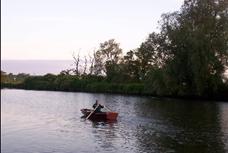
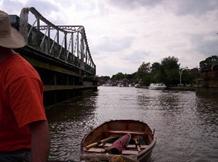
The night is indeed short as we arise at 05:00. Ten minutes later, with no sign of wind despite the forecast, we set off quanting back down towards Wayford Bridge. At 06:15 we moor just above the bridge and, leaving David to prepare breakfast, Jon and I set off in the dinghy to see if we can reach Honing Lock.
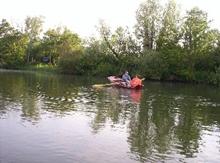
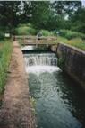
With the lack of wind continuing we leave the rig behind. We will rely on the oars. Up to Tonnage Bridge the channel is wide, and would be navigable in the yacht. Indeed just below the bridge a privately owned yacht is moored. About half a mile further on and the way divides, with a small spur going up to East Ruston. This point marks the end of the easy progress. From here on the lilies and other weeds intrude more and more. Rowing becomes increasingly difficult. Eventually I resort to using one oar over the bow of the dinghy, with a technique akin to a canoeist’s draw stroke. In this manner we eventually reach the lock at 08:00. We have got to our tenth limit.
The return from the lock is a little easier. Our technique is better developed and we have also cleared a channel on our way up. By 09:00 we are back at the yacht.
We set off straight away. There is now wind in the treetops, but it is light and from ahead at river level, so we quant down to Barton Broad. We moor up on the public moorings at the top of the broad, on the north side of the island with the strange name of The Heater. Refreshed, we prepare to hoist sail in the rapidly freshening wind. We opt for one reef, which is about right on the Broad, but in the tree-lined river below we are a little under canvassed. No matter, because by Howe Hill we are clear of the trees and the reef is a good thing again. The Ant is a narrow river, and tacking is not easy, particularly when there are motor cruisers wanting to get past. There are no real problems though, and by early afternoon, we are at Ludham bridge. As we are dropping the mast, we see the distinctive sails of two Hunter’s yachts coming up the river, the first we’ve seen since leaving the yard. I walk down to the bridge and find that the two Wood class yachts have managed to moor opposite the boatyard. The moorings here are closed, but the men working on the repairs are happy for us to stop for masting. There is no room for us as well, so we wait until they have passed upstream before going under the bridge.
Under way again and the reef is definitely needed as we have a lively tack down to Ant Mouth, which we reach at 16:00. Our remaining navigation limits are up the Bure, so that’s the way we go. The direction is west, so with a south wind it’s a beam reach. At least it’s a good theory, in practice, with the many bends, there will be numerous tacking sessions. We carry on up river and the wind begins to ease. We stop at the entrance to Cockshoot Broad to shake out the reef. Here we have our second encounter with Hunter boats, a couple in a Hustler are moored up here. The broad is not navigable, but has a nature trail around it. Another time this trail would be great to explore, but today we will have a quick brew then press on. With the wind almost behind us we quickly reach Horning, but by now we are well into tree country and from the bend at the top of Horning the wind is no longer behind us. Progress slows and the wind drops, slowing it even more. It is nearly 20:30 and a very light wind when we reach Wroxham. With no prospect of making much more progress, we take advantage of civilisation and head for the chip shop. The mast is down and we quant through the bridges.
The first bridge is an arched road bridge. There is a bit more clearance than at Potter Heigham, but it is set at an angle across the river making it difficult to see oncoming traffic. At this time of night however, the traffic is non-existent. We pass through, then under the railway bridge to moor on the Broads Authority moorings. We eat our fish, drink our beer and discuss our options.
It is clear that we cannot make Aylesham. A 24 mile round trip is a very long day’s rowing and we have to be back at the yard tomorrow night. Indeed Jon would like to be back sooner. He has a commitment at home in the evening, but keen for success he will forgo this if it will make a difference. We decide on the earliest possible start, with the intention of making Coltishall then returning to the yard all in one day.
|
Yacht Mileage |
17 |
|
Dinghy Mileage |
4½ |
|
Navigation Limits |
1 |
- Log in to post comments
Day Nine, Friday 17th June
Great Yarmouth 19/6
7am: 16c WD 140deg WS 8kt VIS 14km RAIN 0%
1pm: -10c WD 0deg WS 0kt VIS 0km RAIN 0%
With only today to reach Coltishall, we arise at 04:30. Wind is stirring in the tops of the trees, so we rig and get under way. Unfortunately the tall trees completely mask our sail and we are in a dead calm. What I would give for a topsail! After a quarter hour we have made no more than 300 yards. At one point a pigeon passes us – on foot! At this rate we cannot reach Coltishall, so we moor up whilst we decide what to do. If we cannot get the boat to Coltishall, it can be done on foot, so at 05:45 I set out to walk. There is no footpath so the route is along the road, but at this hour there is little traffic. Also it is not yet uncomfortably hot. 07:05 sees me at the lock. It is our eleventh navigation limit and the last that we will achieve. I phone in my success and by 08:30 am back on the boat. The others have breakfast waiting and I devour it hungrily. There is nothing like a six mile walk first thing to hone the appetite.
After breakfast we drop the mast and head down through the Wroxham bridges, our last of the trip. Below the town we opt to sail on to Wroxham broad, where there is less shelter from the wind. We enjoy an exhilarating sail up and down the broad and take the opportunity to admire Solace, the pleasure wherry, as she swings on her mooring.
Unfortunately we can’t spend all day at this and we return to the river. On a failing wind progress is leisurely, but we are making progress. We eat lunch as we pass St Benet’s Abbey, which despite being a ruin, was never dissolved. The bishop of Norwich is also the abbot to this day.
14:30 sees us back in the yard, and Jon wastes no time in setting off home. He will be able to make his evening appointment. David and I clean and tidy the boat. Along with most Hunter’s clients, we share with the staff a love of the boats, and would not dream of handing one back until it’s spotless. We also enjoy a chat with the Hunter’s staff, who are all impressed with the distances we have travelled and are keen that we should write it up as an encouragement to other sailors. All this done, it is with a feeling of satisfaction that we too climb into the car for the journey home.
|
Yacht Mileage |
11½ |
|
Walking Mileage |
7 |
|
Navigation Limits |
1 |
- Log in to post comments
Afterwards
The travelling is uneventful, and we all enjoy the longest night’s rest since the start of the trip. Unfortunately mine is broken the next morning by beeps from my phone. The weather forecast has arrived. I send the cancel text and bemoan the loss of a lie in. Now it’s time to take stock.
We reached almost all our objectives. I would have liked to have got right up to Norwich Yacht Station, and even taken the dinghy up to New Mill. I still have an ambition to visit my favourite Norwich coffee shop, Olive’s, by boat. There is still the long dinghy trip to Aylesham. There are also obscure little corners to visit. For example, I’ve never been up Catfield Dyke, or sailed quite all the way to Coltishall Lock. (My previous trip to Coltishall ended at the common). There’s also a lot still to see on a more leisurely trip. Despite many visit’s over thirty five years, there is always something new.
Could we have done it all? There is no doubt that we were delayed, firstly by Jon’s late arrival and secondly by the dredger mishap. With an early start we might have been at Yarmouth a day earlier. Without the stop for repairs we may have made Geldeston and started back down the same day as passing through Yarmouth. But all this is speculation. We were often in the right place for the weather. Northerly winds as we headed south, and southerly as we came back north, was more than we could have hoped for. Hardly a drop of rain made for pleasant sailing conditions. Anybody attempting a trip such as this would not be guaranteed success. Also it is important to remember that safety is more important than achievement. Ambitious goals must never be a reason for reckless decisions.
The fund-raising was equally successful. Jon, who had initiated the idea, raised a total of almost £600 for the work of the Romans One Eleven Trust in Uganda. Later in the year Jon visited Uganda to help with the trust’s work. He has written a report on his visit, originally for his college, and published with their consent. He also wrote a few paragraphs on the sailing trip for the college magazine. David raised over £400 for the Guillain-Barré Syndrome Support Group. I must confess to giving relatively little attention to fund-raising, but was still able to contribute a respectable £105 to AYME.
Totals
Yacht Mileage
185
Dinghy Mileage
8
Walking Mileage
7
Navigation Limits
11
- Log in to post comments
References
The essential navigation guide used to be Hamiltons Navigations by Jamie Campbell. Sadly this is now out of print and there is no comparable alternative. If you can get hold of a copy it’s still very useful and informative, although becoming out of date.
For more information on Hunter's Yard and the boats, read Richard Johnstone-Bryden's excellent book "Hunter's Fleet"
For maps I recommend the 1:25000 Ordnance Survey map of the Broads for a large scale detailed map, although the 1:50,000 Landranger mapis adequate and a little cheaper. For more of a tourist map the Geoprojects map is hard to beat.
If you want to know more about the Broads and their history and geography, the following are good places to start:
The Broads (Official National Park Guide)
The Man Who Found the Broads: A Biography of George Christopher Davies by Jamie Campbell
Eating and drinking is fairly well covered in Hamilton's, but for a specific guide, try the Cruising Guide to Inns and Taverns: Norfolk Broads by Rose Lewis. If, like me, you are a Real Ale fan, you may want to cross reference to the CAMRA Good Beer Guide.
For the ultimate entertaining read about a sailing holiday on the broads, The Art of Coarse Sailing by Michael Green is unbeatable. Other authors with stories set on the broads are Arthur Ransome with two of his Swallows and Amazons stories, Coot Club and The Big Six, and CP Snow with his period detective novel Death Under Sail.
- Log in to post comments
Links
These links are provided as a convenience and do not constitute an endorsement. Those we have found particularly useful are mentioned in the text. If you have a Norfolk Broads site that you would like listed, please contact the Webmaster.
Yacht Hire
Local Information
Shorebase (Tides, weather and lots of information)
Broadsnet: Pete's Norfolk & Suffolk Broads Cruising Guide
Greg Browning’s Broads photographs
Norfolk and Suffolk Boating Association (The Green Book)
Weather
General
- Log in to post comments